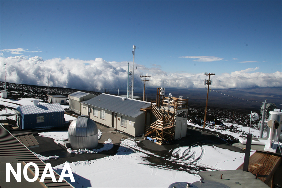
Spectacular footage from inside a hurricane; a major ocean mapping milestone; new insights on the continued impacts of climate change, and much more — 2021 was a busy year for NOAA Research. As the year draws to a close, we’re taking a look back at a few of our biggest research stories of the last 12 months. Spectacular footage from inside a hurricane; a major ocean mapping milestone; new insights on the continued impacts of climate change, and much more — 2021 was a busy year for NOAA Research. As the year draws to a close, we’re taking a look back at a few of our biggest research stories of the last 12 months. Greenhouse gas emissions are on the rise – but there’s one pollutant that’s falling 2021 was a big year for climate records. In May, carbon dioxide measured at NOAA’s Mauna Loa Atmospheric Baseline Observatory peaked for 2021 at a monthly average of 419 parts per million ppm. That’s the highest level since accurate measurements began 63 years ago, according to NOAA and Scripps Institution of Oceanography scientists. NOAA’s Mauna Loa Observatory is critical for tracking carbon dioxide – it’s a remote location with little vegetation and human activity, so it represents a good baseline for atmospheric greenhouse gas levels. This CO2 record occurred in spite of pandemic shutdowns. In fact, scientists reported in April that levels of CO2 and methane – a potent greenhouse gas – continued to rise in 2020, despite the temporary drop in carbon emissions caused by the pandemic-induced economic recession. That rise in greenhouse gas emissions is projected to continue, according to a November report from the Global Carbon Project which uses NOAA data. Increasing greenhouse gas emissions continue to warm the planet and exacerbate the impacts of climate change already being felt across the globe.
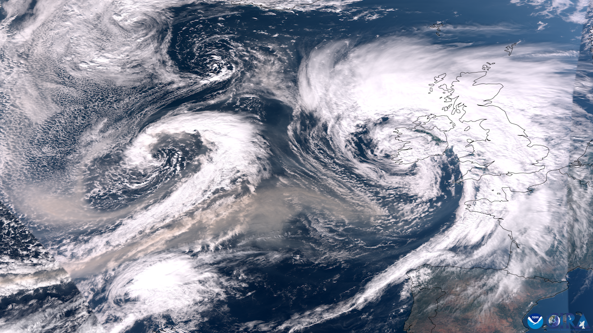
One pollutant that’s on the decline, however? The ozone-depleting chemical chlorofluorocarbon CFC-11. In a win for the Montreal Protocol – the international agreement aimed at phasing out ozone-depleting substances – NOAA scientists found that emissions of CFC-11 dropped sharply between 2018 and 2019, five years after they spiked unexpectedly. Autonomous tools push the limits of data collection It was a world first: a plucky, bright orange saildrone capturing video footage from inside a hurricane. In September, the Saildrone Explorer SD 1045 battled 50 foot waves and winds of over 120 miles per hour to collect critical scientific data on Category 4 Hurricane Sam. The footage gave scientists a brand new view of one of earth’s most destructive forces. Saildrones are autonomous, solar-powered ocean tools that can gather a wide range of environmental data, including fisheries abundance, solar radiation, ocean salt content and sea surface temperature. SD 1045 was one of a fleet of five ‘hurricane’ Saildrones that operated in the Atlantic Ocean during hurricane season, gathering data around the clock to help scientists understand the physical processes of hurricanes. This knowledge is critical to improving storm forecasting and storm preparedness in coastal communities.
Saildrones aren’t the only autonomous tools NOAA is using for hurricane research: In 2021, scientists also tested out aerial drones, which they hope can be used to gather key data in hurricanes. And NOAA also uses a range of moored and free-floating buoys and other ocean observing platforms to keep tabs on the global ocean — including in remote, hard-to-reach areas. Ocean Explorer hits a mapping milestone – and makes a big discovery! Two million square kilometers. That’s officially how much ocean floor NOAA Ocean Exploration scientists have mapped aboard NOAA Ship Okeanos Explorer, a milestone hit in late 2021. If you’re curious, that’s 772,204 square miles – and more than one quarter the size of the contiguous United States! A big part of NOAA Ocean Exploration’s mission is mapping the seafloor. But why is mapping important? The first step in ocean exploration is mapping, as it provides scientists information about the geological features and creatures of the deep ocean. Once we know what the seafloor looks like, and what ecosystems it hosts, we can better understand, manage and protect it. In 2021, NOAA Ocean Exploration also made a big discovery: A shipwreck! In October, as part of its Windows to the Deep Expedition, NOAA Ocean Exploration discovered Bloody Marsh, a T2-SE-A1 oil tanker that was sunk off the coast of South Carolina on July 2, 1943, by a torpedo from a German submarine. Read more about the discovery and take a look back at the other big finds from the 2021 Windows to the Deep Expedition. Climate change comes to the deep waters of the Great Lakes The Great Lakes make up the largest freshwater system in the world, holding over 80 percent of North America’s available surface freshwater. They’re also depended upon by millions of residents in the region for drinking water, recreation and industry. These lakes are also sentinels of climate change, and a long-term study published in 2021 found that their deep waters are warming, a discovery that could lead to major ecological change. “We found that this long-term data set not only confirms that Lake Michigan’s deep waters are warming, but also shows that winter is vanishing from them,” said former NOAA Great Lakes Environmental Research Lab scientist Eric Anderson, the study’s lead author. Deep water warming isn’t the only sign of climate change in the Great Lakes. Scientists have also found that climate change has gradually delayed the onset of cooler autumn weather over the past three decades, and that ice cover has been declining since 1973 and is expected to continue to decline as the climate warms. Former NOAA scientist wins Nobel Prize
Finally: A well-deserved honor for a former NOAA scientist and pioneer in the climate science field. In October, former NOAA scientist Syukuro Manabe was awarded the 2021 Nobel Prize in Physics for his lifetime of work in climate science. Manabe, who worked for several decades at NOAA’s Geophysical Fluid Dynamics Laboratory, is a legend in the climate field, building the foundation for today’s climate models by developing the first three-dimensional models of the atmosphere. Manabe’s research was pivotal in informing how scientists perceive the Earth’s climate and how human actions continue to influence it. He shares the Nobel Prize in Physics with fellow climate scientist Klaus Hasselmann of the Max Planck Institute for Meteorology in Hamburg, Germany; and Giorgio Parisi of the Sapienza University of Rome, Italy. An inspiration to us all, Manabe, 90, remains active today as a NOAA affiliate at Princeton University’s Forrestal campus.