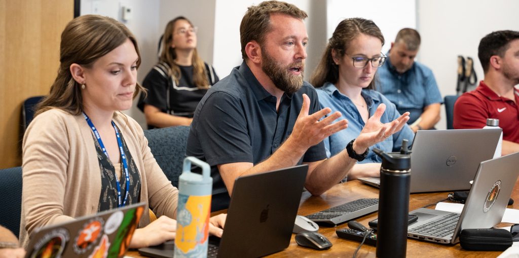
Two experimental tools that will speed fire detection and warning got a week-long test run in NOAA’s new Fire Weather Testbed in June during a series of hands-on simulations with National Weather Service fire weather forecasters, state wildfire managers, researchers, and social scientists.
The first, NOAA’s Next Generation Fire System, or NGFS, uses artificial intelligence to rapidly and autonomously identify fires from observations made by geostationary satellites. By quickly communicating information to forecasters and land managers, it reduces response time when a swift initial attack is most critical.
NGFS, which was developed by NOAA Satellites, uses artificial intelligence to rapidly and autonomously identify fires from observations collected by NOAA’s geostationary satellites. By quickly communicating information to forecasters and land managers, the new system reduces response time when a swift initial attack is most critical.
The second, the application of the Integrated Warning Team paradigm to wildfire, speeds the exchange of information between meteorologists and land managers and fire agencies to issue fire warnings through NWS channels for rapidly spreading wildfires threatening life and property.
“The tools and concepts we evaluated will turn our meteorologists into scientific first responders in partnership with fire, land and emergency agencies,” said Todd Lindley, the NWS Science and Operations Officer for Norman, Oklahoma, who spearheaded the adaptation of the Integrated Warning Team concept to fire warnings. “These tools will help us provide timely and life-saving warnings of particularly dangerous wildfires.”

Inside the Fire Weather Testbed
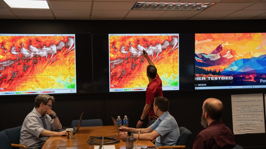
For a week, teams of experienced fire weather forecasters and state forestry and fire managers ran through seven simulations based on past wildland fires in the Southern Plains, Rocky Mountains and Pacific Northwest.
During each exercise, teams reacted to the actual weather and fuels forecasts leading up to the fire outbreaks. As the simulation unfolded, meteorologists evaluated new observations and satellite data along with changes in weather. They used chat rooms to alert their forestry and firefighting partners of emerging hotspots and evolving weather conditions. The fire managers then identified lives and property at risk, and collaborated with their NWS partners to determine if the areas in a wildfire’s path needed a fire warning.
Both the Fire Weather Testbed, located at NOAA’s Global Systems Laboratory in Boulder, Colorado, and the Next Generation Fire System, developed by NOAA Satellites, are funded by the Bipartisan Infrastructure Law to advance wildfire detection, observation, modeling and forecasting capabilities.
Eyes in the sky, teams on the ground
NOAA’s GOES satellites are in geostationary orbit 22,000 miles above the Earth, but NGFS can detect a fire as small as one acre, said Michael Pavolonis, the NOAA Satellites Wildland Fire Program manager. After detection, the NGFS displays information about the fire’s location and intensity on a dashboard that provides access to satellite imagery and other data layers such as fire weather outlooks and Red Flag Warnings, wildfire incident perimeters, governmental boundaries, agency jurisdictions, and fuels data, which are essential context for decision-making.
“The artificial intelligence and data fusion capabilities within the NGFS enable efficient and effective decision-making,” Pavolonis said.
The first Integrated Warning Team fire warnings were issued during March 2022 in Oklahoma. During a fire near Wichita Falls a little more than a year later, an Integrated Warning Team alerted incident commanders to move firefighting crews to safety just before a dangerous wind shift. Similar warnings were issued during nine separate wildfires in Oklahoma and Texas during 2022 and 2023, and during the February 2024 southern Great Plains firestorm.
GSL social scientists participated in the design and preparation of the exercise. At the end of the week, they surveyed participants to gain additional feedback, and conducted focus group discussions to explore opportunities and barriers for implementation into fire operations.
Zach Tolby, Fire Weather Testbed manager, said one of the testbed’s advantages is it allowed teams to evaluate new tools and warning services on many more events than would happen in reality. He called the evaluation “an overwhelming success.”
“This was a complex, end-to-end evaluation of NOAA’s new fire detection, partner collaboration and Fire Warning tools and services,” Tolby said. “We look forward to analyzing the data and assisting NOAA Satellites and the NWS in deploying these new technologies and services to support wildfire operations across the country.”
For more information, please visit the Global Systems Laboratory’s Fire Weather Testbed page.