Our ocean and coasts are home to a diversity of life from the smallest single-celled plankton, to the largest animal on Earth, the blue whale. The ocean provides us with vital resources and plays a large role in the climate of our planet. Let’s dive into learning about some of the ways NOAA is dedicated to exploring and understanding our global ocean through expanding ocean exploration initiatives and increasing our observational and monitoring capacities.
Through exploration, NOAA is constantly learning more about the ocean’s biological, geological, and maritime heritage aspects. Exploration leads to discovery, but before one can truly explore, one must map the seafloor. As of 2023, only 25% of the global seafloor had been mapped with modern high-resolution technology. While almost 50% of the seafloor beneath U.S. waters had been mapped to these modern standards, the nation’s seafloor is larger than the land area of all the states and territories combined. Thus, there’s still a significant amount of seafloor left to be mapped at high resolution.
During a recent mapping effort off the southeastern U.S., NOAA Ocean Exploration and partners confirmed the largest known deep-sea coral reef habitat in the world. Findings like these are crucial for understanding how deep-sea communities are interconnected across the globe. With this information, we can predict how deep-sea communities are impacted by human activities and develop effective strategies to protect them. To learn more about deep-sea ecosystems, check out NOAA Ocean Exploration’s Ocean Month feature story: Meet the Deep.
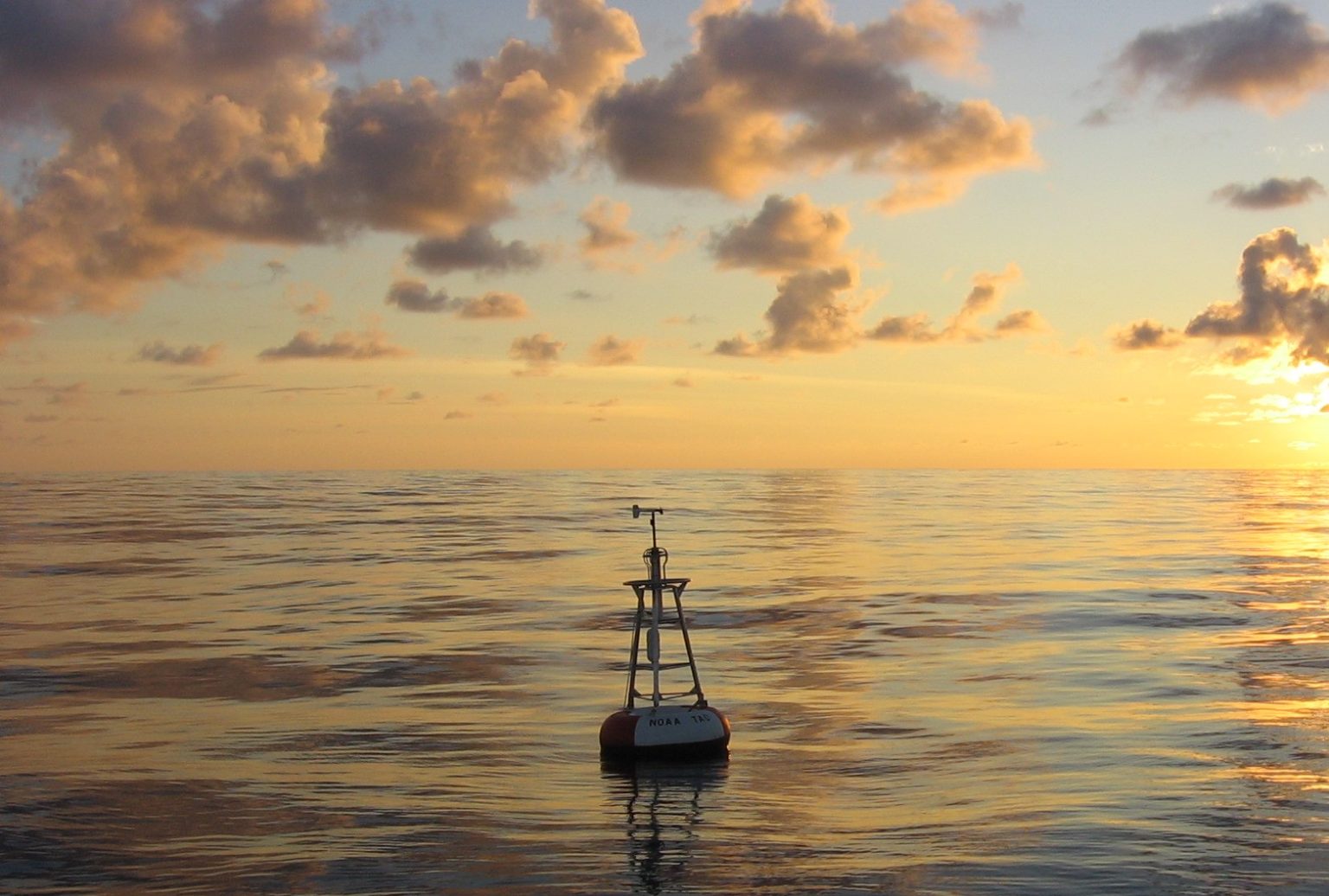
NOAA is advancing our knowledge of how the ocean is changing and its influence on weather and climate through a variety of observational networks. By using Argo floats, gliders, drifters, and moored buoys, scientists are improving weather, marine, and ocean prediction models. For instance, NOAA uses observational data in marine heatwave research and forecasting. NOAA’s National Data Buoy Center plays a key role by collecting and distributing real-time, quality-controlled marine observations from 1,300 weather observing stations. This data, as well as long-term in situ data collected from research stations, such as the crucial Ocean Weather Station Papa station, is utilized by NOAA scientists to understand how the ocean is responding to increasing carbon dioxide levels and develop ocean heat forecasts. These NOAA products are essential for informing management decisions for climate adaptation and enhancing community resilience.
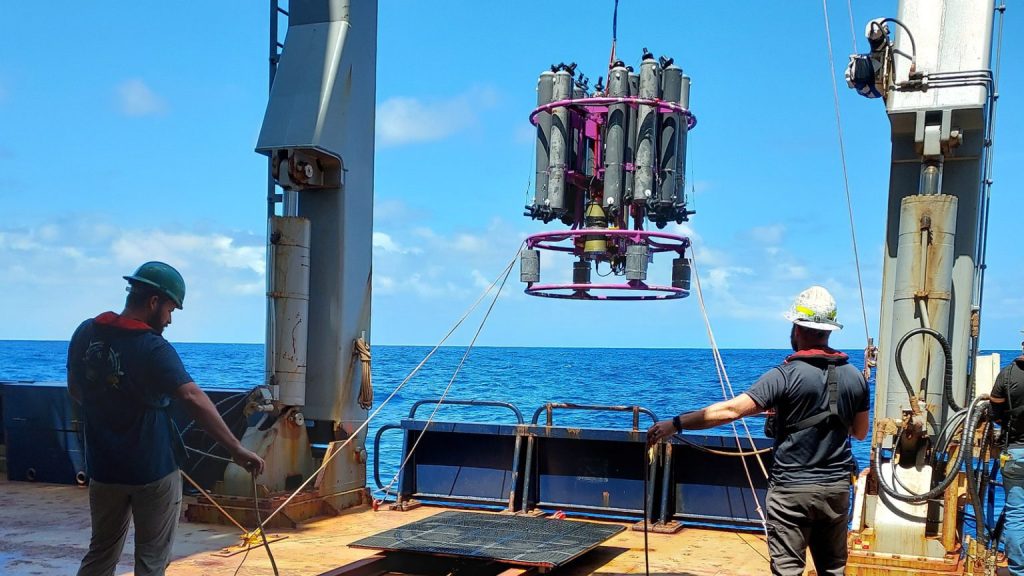
Ocean heat significantly impacts marine ecosystems, weather patterns, and economic activities. A recent study used advanced observational tools like uncrewed surface vehicles, moored ocean buoys, and satellite data to investigate how changes in ocean surface temperatures influence atmospheric stability and movement. The results demonstrated the value of using these tools for providing high-resolution data in both time and space, filling important gaps in understanding air-sea interactions across the world’s oceans. Gathering this type of data helps scientists improve climate models and weather prediction, leading to more effective strategies for mitigating the impacts of climate change.
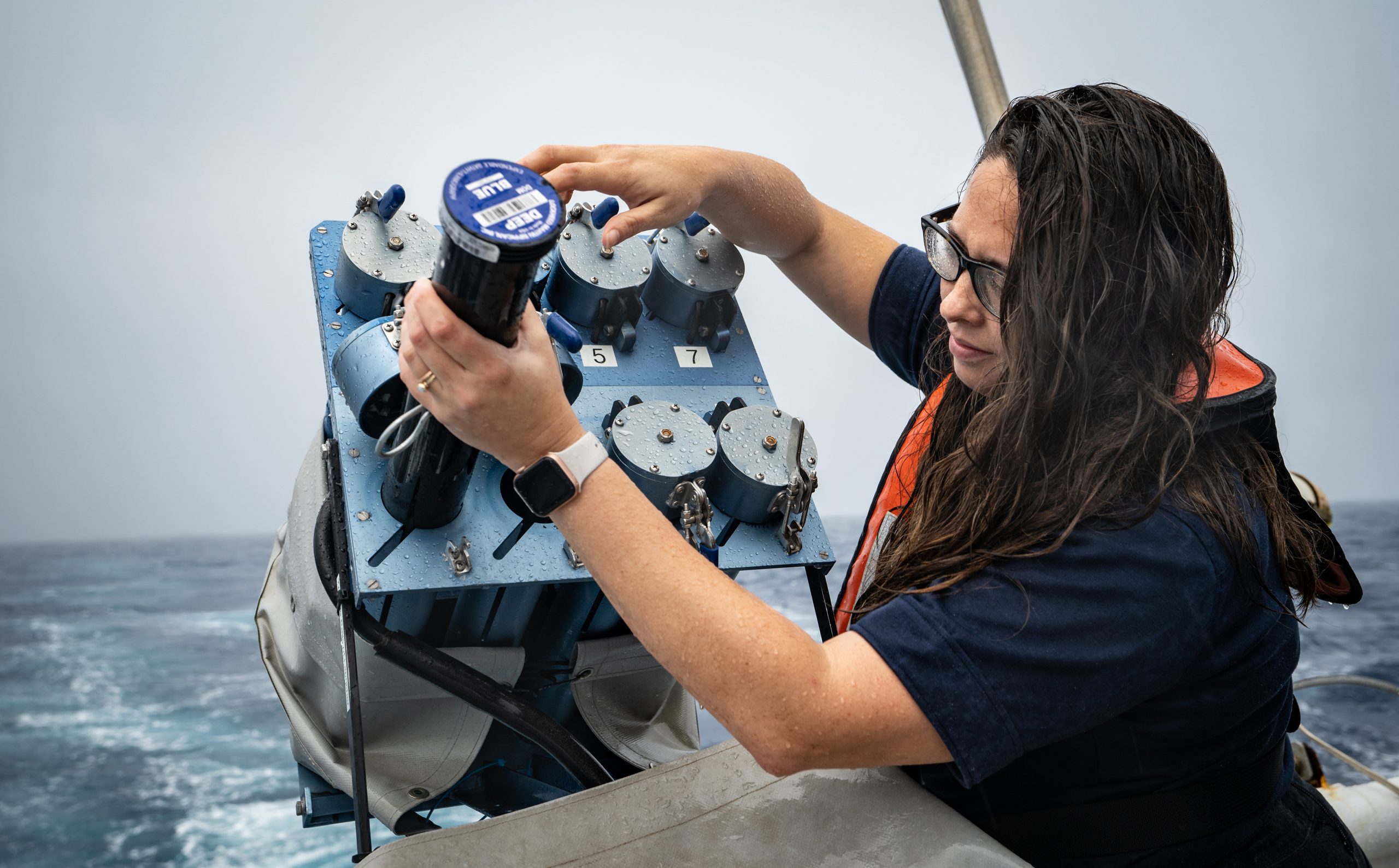
Monitoring global ocean conditions is just as essential as exploring it. Recently, NOAA scientists returned home after 52 days at sea, completing a successful Global Ocean Ship-Based Hydrographic Investigation (GO-SHIP) cruise and contributing to a long term data set that began in the 1970s. This cruise followed one of the 58 GO-SHIP transects that monitors multiple ocean parameters. During their time at sea, scientists collected necessary data for investigating global changes in ocean physics and chemistry – most notably, the uptake of atmospheric carbon under climate change. Data collected on this cruise and other GO-SHIP missions are essential for understanding how the Atlantic Ocean overturns mass, heat, and freshwater transports.
GO-SHIP data was recently used in a study that found that the abyssal leg of the Atlantic Meridional Overturning Circulation (AMOC) has weakened by 12% in the past two decades. This weakening of the AMOC is associated with an observed increase in deep sea heat and sea level rise in the North Atlantic. The results from this study support numerical models that show human activity could potentially cause circulation changes not only in the Atlantic, but throughout the global ocean.

Even with all of NOAA’s current exploration, monitoring, and observing efforts, the ocean still has many secrets we have yet to learn. Looking forward, there is a great need to learn more about our ocean to help understand our weather and climate, to support economic development, and to protect marine life. Stay up to date with current and future ocean research here at NOAA by visiting our website and following us on Instagram, Twitter, and Facebook.