On May 17, 1974, staff of the new National Oceanographic and Atmospheric Administration’s Geophysical Monitoring for Climatic Change program took their first atmospheric measurements for what would become one of the most scientifically significant records of humanity’s impact on Earth’s climate.
Since then, NOAA’s Global Monitoring Laboratory’s continuous measurements of atmospheric carbon dioxide (CO2) at the Mauna Loa Observatory have contributed to the longest modern datasets of this important greenhouse gas. NOAA’s daily measurements provide independent observations that complement measurements taken by the University of California San Diego’s Scripps Institution of Oceanography, which started sampling in 1958. The sustained, collaborative effort has helped educate scientists and the public about the relentless rise of CO2 caused primarily by fossil fuel pollution.
The concentration of carbon dioxide, or CO2, in that first sample was 333.46 parts per million (ppm). This month, as the annual CO2 cycle peaks, concentrations have been averaging 427 ppm, more than 90 ppm above the 1974 level.
“The long-term measurements at Mauna Loa have given us an accurate and unmistakable record of humans’ impact on the only atmosphere we have,” said Vanda Grubišić, director of the Global Monitoring Laboratory (GML).
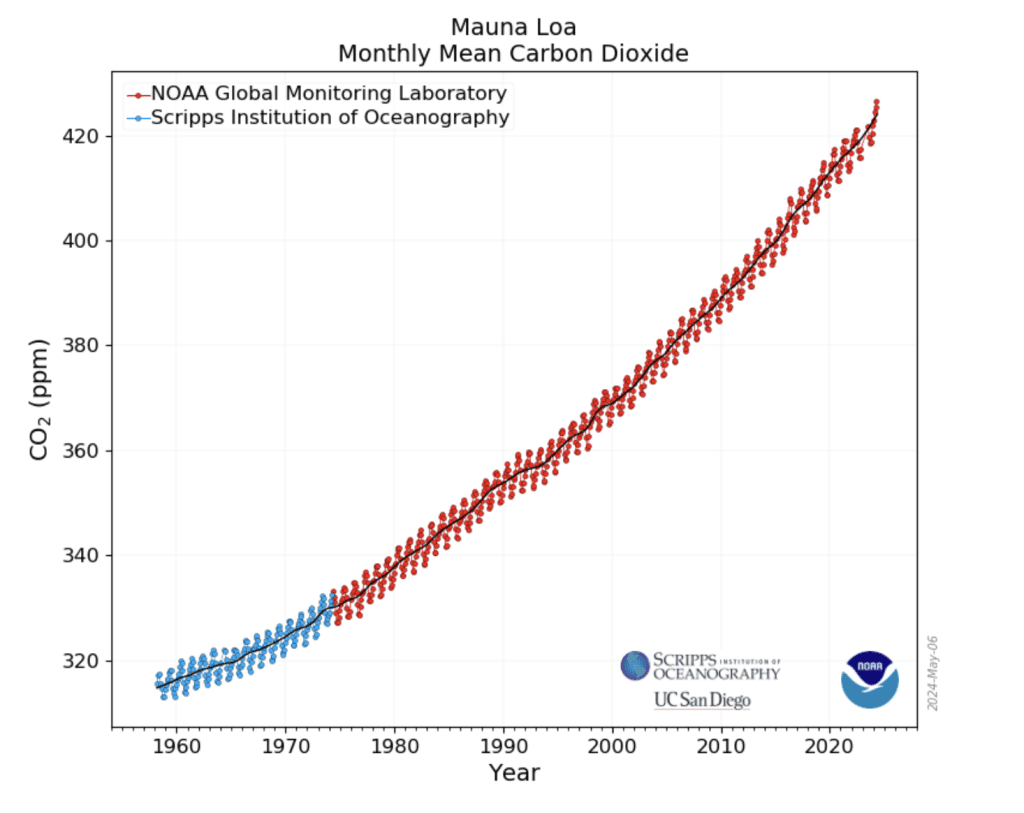
This graph shows the full record of monthly mean carbon dioxide measured at Mauna Loa Observatory, Hawaii, by NOAA and the Scripps Institution of Oceanography. Credit: NOAA Global Monitoring Laboratory
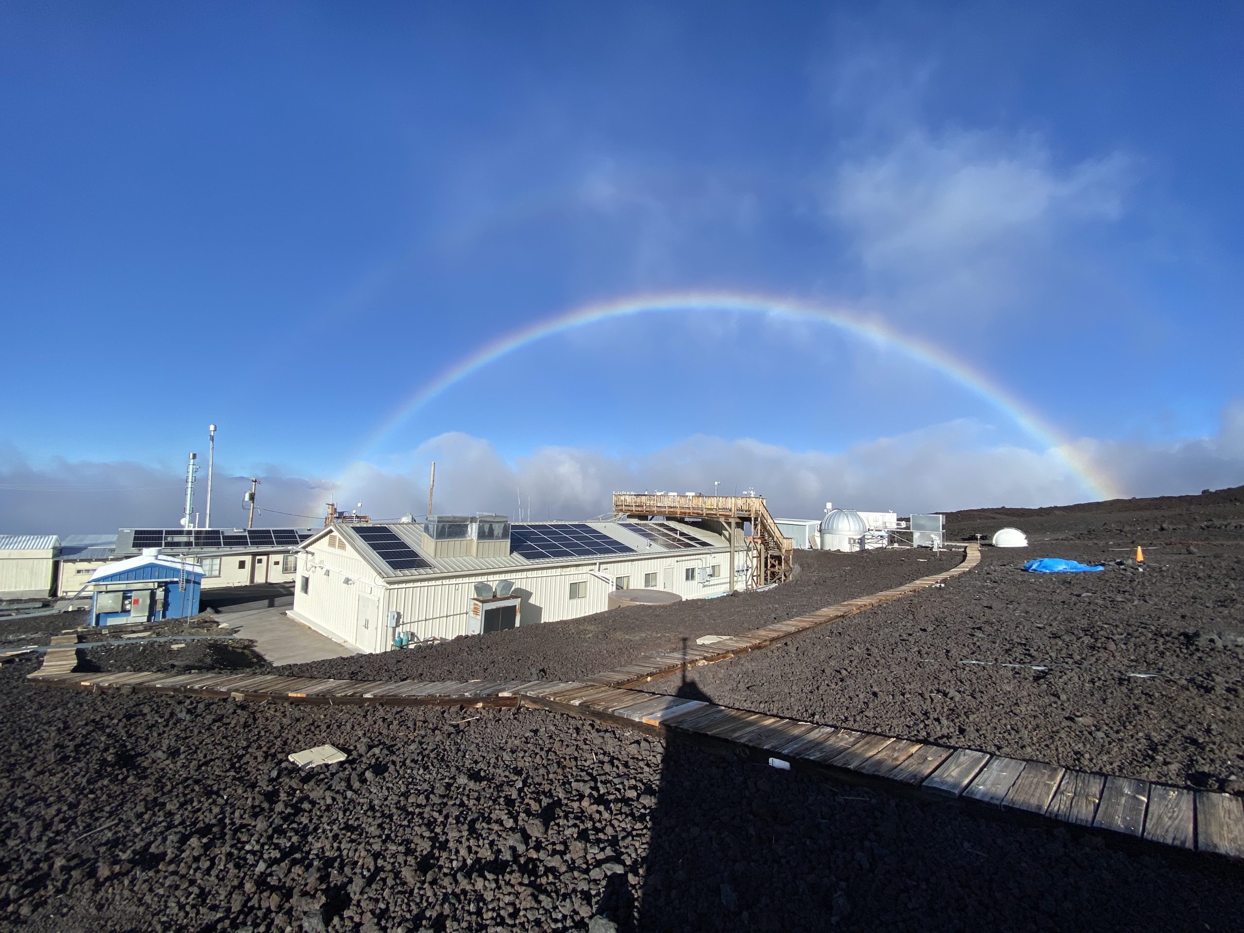
Perched high on the barren slopes of the Mauna Loa volcano in the middle of the Pacific Ocean, the observatory protrudes through the strong marine boundary layer temperature inversion that separates the more polluted lower portions of the atmosphere from the much cleaner free troposphere. The 11,135-foot elevation above sea level is ideal for sampling well-mixed air undisturbed by the influence of local pollution sources or vegetation, producing measurements that represent the average state of the atmosphere in the northern hemisphere.
The characteristics that make the site ideal for measuring CO2 also provide ideal conditions for a wide variety of other atmospheric research efforts. The observatory’s 10 buildings house instruments that collected up to 250 climatological measurements for NOAA and partner agency scientists and engineers every day before the eruption of the volcano cut off access to the site in November 2022.
In the beginning
The Mauna Loa Observatory was established by the U.S. Weather Bureau, the precursor to NOAA’s National Weather Service, on June 28th, 1956, but not to monitor climate. Instead, scientists made routine weather observations and studied atmospheric circulation. They also made observations of solar radiation, cosmic radiation, fallout from atomic tests, snow crystals, meteors, the Sun’s corona, even the atmosphere of Mars.
Charles David Keeling was the first to observe that CO2 levels rose and fell every year in concert with the seasons, a dynamic which is now known as the Keeling Curve. The highest monthly mean CO2 value of the year occurs in May, just before plants in the northern hemisphere start to remove large amounts of CO2 from the atmosphere during the growing season. In the northern fall, winter, and early spring, plants and soils give off CO2, causing levels to rise through May.
Keeling was also the first to recognize that despite the seasonal fluctuation, average CO2 levels were increasing every year. Not only has that trend continued, but the rate of the annual increase has also risen – sharply – in recent decades. (Keeling’s son, geochemist Ralph Keeling, runs the Scripps program at Mauna Loa.)
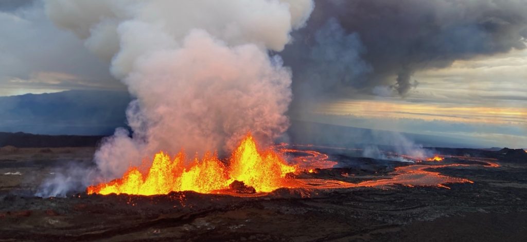

This aerial photograph shows the dominant fissure erupting on the Northeast Rift Zone of Mauna Loa, taken at approximately 8 a.m. Hawaii Standard Time on November 29, 2022. Lava fountains were up to 25 m (82 ft) that morning as the vent was feeding the main lava flow to the northeast. Credit: M. Patrick/USGS photo
The volcano awakes
On Nov. 27, 2022, lava flows from the erupting Mauna Loa volcano buried more than a mile of the access road and destroyed power poles, temporarily interrupting all scientific activity at the observatory. NOAA and Scripps scientists were able to quickly set up alternative sampling sites for some measurements, including CO2, at Maunakea.
In 2023, MLO staff visiting the site once a week via helicopter restored limited power to four key observatory buildings by augmenting existing solar generation and adding battery systems. Approximately 33 percent of the atmospheric measurements on the mountain site have been restored, including consistent measurements for greenhouse gases, halocarbons and trace gases, ozone, aerosols and global radiation. Reconstruction of the access road to the observatory is anticipated in 2025.
The Mauna Loa Observatory is one of four NOAA atmospheric baseline observatories strategically situated from the Arctic to the South Pole, each of which collects numerous daily in situ and remote atmospheric and solar measurements. Continuous measurements of atmospheric CO2 at the Barrow Observatory near the community of Utqiaġvik, Alaska began in July 1973, at the South Pole Atmospheric Research Observatory in January 1975, and at the American Samoa Atmospheric Baseline Observatory in January 1976.
To explore more information about the CO2 record at Mauna Loa Observatory, visit the GML website’s Trends in CO2 page.
For more information, contact Theo Stein, NOAA Communications: theo.stein@noaa.gov.
