With the current El Niño in full force, researchers are still puzzling over the 2020–2023 La Niña that upended current understanding of El Niño Southern Oscillation (ENSO) dynamics. The three consecutive years of La Niña conditions – a rare “triple-dip” phenomenon – had widespread impacts on the ocean and climate across the globe. While triple-dip La Niñas have happened before, this one was notable in that it did not conform to conventional theories on how these extended La Niñas develop, leaving scientists searching for clues to explain what caused it.
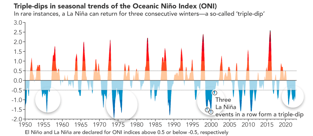
What are “triple-dip” La Niñas?
La Niña is the cool phase of ENSO, a major form of climate variability that influences temperature, precipitation and extreme weather patterns worldwide. La Niña conditions develop when equatorial trade winds intensify and cause colder, deeper water to rise to the surface, essentially cooling the Pacific Ocean. While ENSO cycles typically last 9-12 months and pop up intermittently every two to seven years, “triple-dip” La Niña conditions persist for three successive years.
NOAA Senior Scientist Michael McPhaden wrote about the 2020–2023 La Niña in the 2022 State of the Climate Report. “Compared with single-year ENSO events, triple-dip La Niñas lead to elevated risks from natural hazards like droughts, floods, heat waves, and weather extremes simply because they last so long,” said McPhaden, an oceanographer at the Pacific Marine Environmental Laboratory. “There were parts of the globe where it was disaster after disaster because of the extended period of cold in the tropical Pacific over these three years.” The 2020-2023 La Niña saw impacts ranging from back-to-back years of extreme rainfall and flooding in Australia, prolonged droughts leading to food security issues in Africa, and exceptional drought in the southwestern United States. La Niñas are also often linked to greater Atlantic hurricane activity, which is exactly what we saw with record-breaking and above-average hurricane seasons in 2020 and 2021.
What caused the 2020–2023 triple-dip La Niña?
Triple-dip La Niñas are not new, with particularly strong ones occurring in 1973–1976 and 1998–2001. However, these two previous events developed in the wake of especially strong El Niños, which were thought to be precursors for triple-dip La Niñas. The leading theory was that strong El Niños cause a significant loss of heat from the equatorial Pacific Ocean to the atmosphere and to higher latitudes, leaving a large ocean heat deficit that can take years to recover. However, the 2020–2023 La Niña was unique in that it did not follow a strong El Niño, causing researchers to reevaluate current understanding of how these extended La Niñas develop.
One possibility is that ENSO – which was previously thought to be driven by processes primarily occurring within the tropical Pacific Ocean basin – is more susceptible to inter-basin interactions involving the Indian and Atlantic Oceans. Many recent studies such as this one have also argued that influences from the North and South Pacific Ocean may play an important role in promoting prolonged La Niña events. It has even been suggested that smoke from the extensive Australian bushfires in 2019–2020 may have helped to trigger the recent La Niña. These studies underscore the idea that there may be significant sources of ENSO variability originating outside the tropical Pacific Ocean and that we need a more global approach for understanding and predicting ENSO cycle variations.
Additionally, a recent comparative study of the 1998–2001 and 2020–2023 triple-dip La Niñas concluded that shifting background conditions in the tropical Pacific Ocean and atmosphere, possibly linked to climate change, could be altering the character of El Niño and La Niña events. A related study examining multi-year La Niñas over the past 100 years arrived at similar conclusions. “The background oceanic and atmospheric conditions of the tropical Pacific determine the nature of ENSO cycle variations,” McPhaden said. “Over the past 40 years, the tropical Pacific has been trending towards a state that resembles a permanent La Niña-like condition, which could be tilting the odds towards more strong multi-year La Niña events like we just witnessed.” A recent analysis of climate models under future warming scenarios also suggests that multi-year La Niñas could become more common, which is a concern given their consequential impacts on society and the environment.
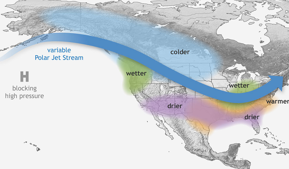
ENSO redistributes global heat, leading to extreme weather around the world.
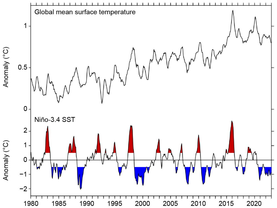
Sorting through what caused the recent triple-dip La Niña is a new challenge that has generated a lot of excitement in the research community. It turns out that the extended, colder La Niña conditions masked a rise in global mean surface temperatures that we might have expected over the past few years due to increasing greenhouse gas concentrations in the atmosphere. Year-to-year variations in global temperature are strongly influenced by ENSO, which redistributes heat and energy on a global scale since the tropical Pacific Ocean absorbs more heat from the atmosphere than usual during La Niña and releases more heat during El Niño.
“The 2020–2023 triple-dip La Niña may have offered temporary relief from rising global temperatures, but the reemergence of a strong El Niño in the past few months has led to a rapid release of heat stored in the upper ocean,” McPhaden added. “So, it’s not surprising that this past summer saw record-breaking temperatures, so many extreme weather events, and widespread marine heatwaves. Climate change is the underlying cause for many of these extremes, but ENSO affects the timing, intensity and regionality of impacts. We need to better understand how these two climate phenomena conspire to produce natural hazards that put life, property, and natural systems at significant risk.”
Research and monitoring can help us better prepare for ENSO impacts in the future.
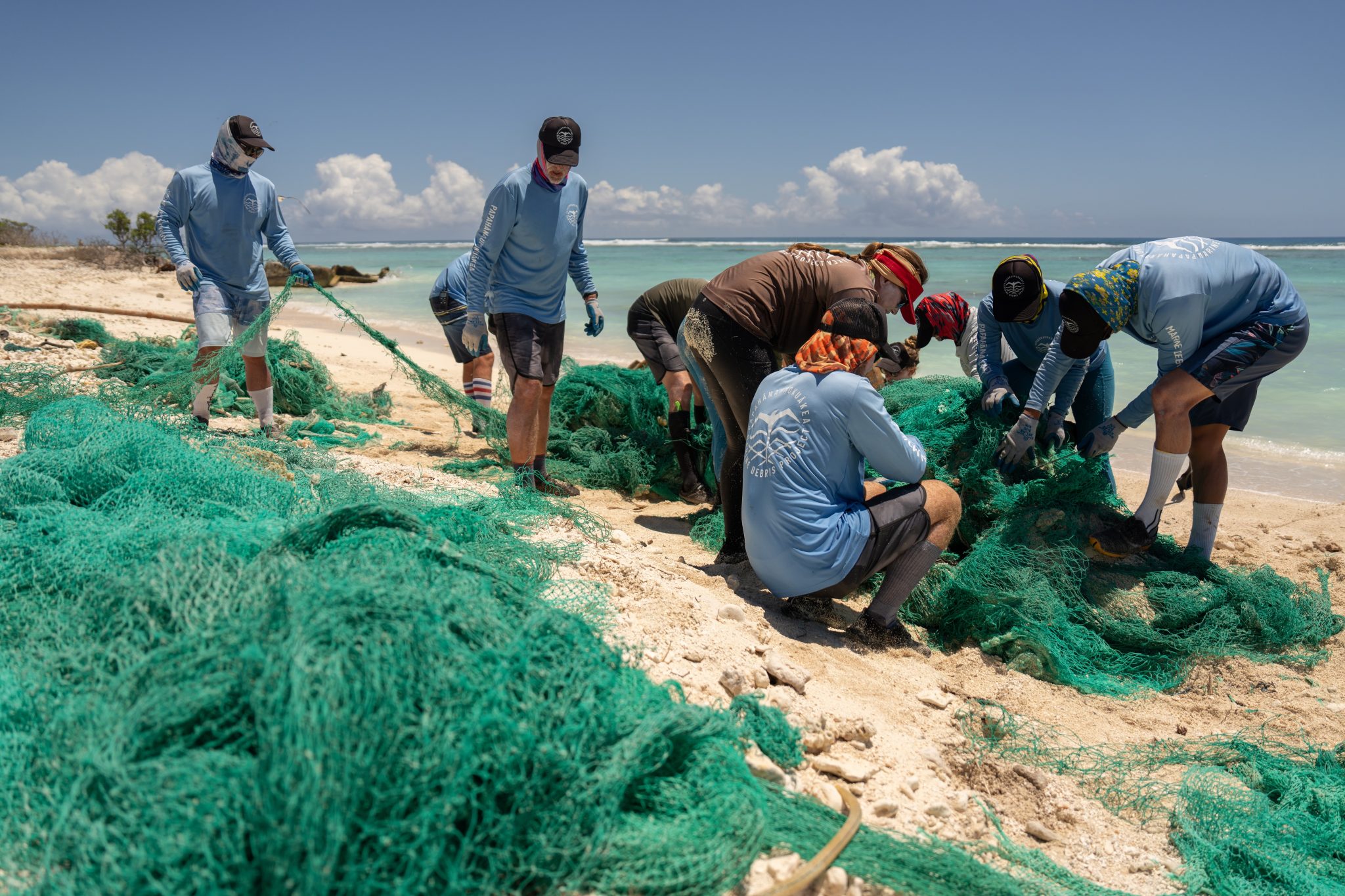
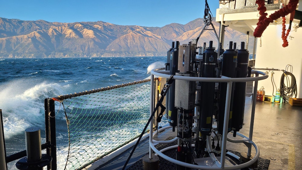
The 2020–2023 La Niña showed us that current ENSO concepts may no longer be serving us well in the context of a changing climate. As climate change continues to shift our planet to new norms, the need to continue observing and investigating processes in our ocean and atmosphere system is even more urgent. In situ ocean observations from platforms like Argo profiling floats and the Global Tropical Moored Buoy Array, supported by NOAA’s Global Ocean Monitoring and Observing Program, as well as critical sea surface temperature, surface height and surface wind measurements from satellites, have been instrumental for documenting changes in our ocean over the last several decades. Sustaining long-term ocean and climate records from these and other observing platforms is necessary to improve our understanding and ability to predict ENSO, its impacts, and how it may change in the future.