2022 was a busy year for volcanic eruptions with Hawaii’s Mauna Loa and Kilaeau erupting simultaneously, along with Mount Semeru, Indonesia and the Hunga undersea volcano in Tonga. While the United States Geological Survey is the primary agency that monitors volcanic activity in the United States, the National Oceanic and Atmospheric Administration (NOAA) oversees safety systems for tsunamis and other volcano-related threats, as well as studies the impact of volcanic gasses on our global climate.
When a volcano erupts, NOAA provides data, satellite imagery and other information used in air quality alerts, ashfall advisories, and tsunami warnings. Mauna Loa, located on the big island of Hawaii, erupted in 2022 for the first time since 1984. During this eruption, which could be seen from space, NOAA and partners released air quality alerts to protect people from vog, a hazy mixture of sulfur dioxide gas and particulate matter.
NOAA’s GOES WEST Satellite was used to track ash plumes from Mauna Loa in order to create volcanic ash advisories. These advisories are used in aviation safety warnings. Local NOAA weather forecast offices used these advisories as well as information from the HYSPLIT volcanic ash model to keep aviation officials updated on local conditions. When Mount Redoubt erupted in Alaska in 2009, NOAA provided forecast and advisory information for volcanic ash. These volcanic ash advisories were issued in close interagency coordination with the USGS for rapid, cohesive delivery of information to decision-makers in emergency management and air traffic.
Some volcanic eruptions are powerful enough to trigger tsunamis, such as the Krakatau eruption in Indonesia in 1883 which triggered one of the largest and most destructive tsunamis ever recorded. Today, NOAA has an advanced tsunami warning system in place to alert communities that are at risk of tsunami conditions after a volcanic eruption. In 2022, the Hunga Tonga – Hunga Ha’apai volcano triggered a tsunami across the Pacific. Immediately after the eruption, tsunami advisories were initiated by a network of NOAA Deep-ocean Assessment and Reporting of Tsunamis (DART) buoys. DART buoys are currently deployed throughout the world’s ocean basins and send real-time data to NOAA’s tsunami warning centers so critical alerts can be issued before any surge of water reaches coastal communities.
The Hunga Tonga eruption also created a 300 mile (500 km) wide plume of toxic gas and ash that traveled into the stratosphere, which provided NOAA scientists with a rare opportunity to learn more about how volcanic emissions impact our global climate. Scientists quickly traveled to remote Reunion Island in the middle of the Indian Ocean where they deployed a collection of scientific weather balloons equipped with Portable Optical Spectrometers (POPS) to collect detailed atmospheric data. POPS are lightweight aerosol sensors that collect data used to refine atmospheric models and improve researchers’ understanding of how volcanic explosions affect the Earth’s atmosphere. This collaboration marked the quickest scientific response to a volcanic eruption to date.
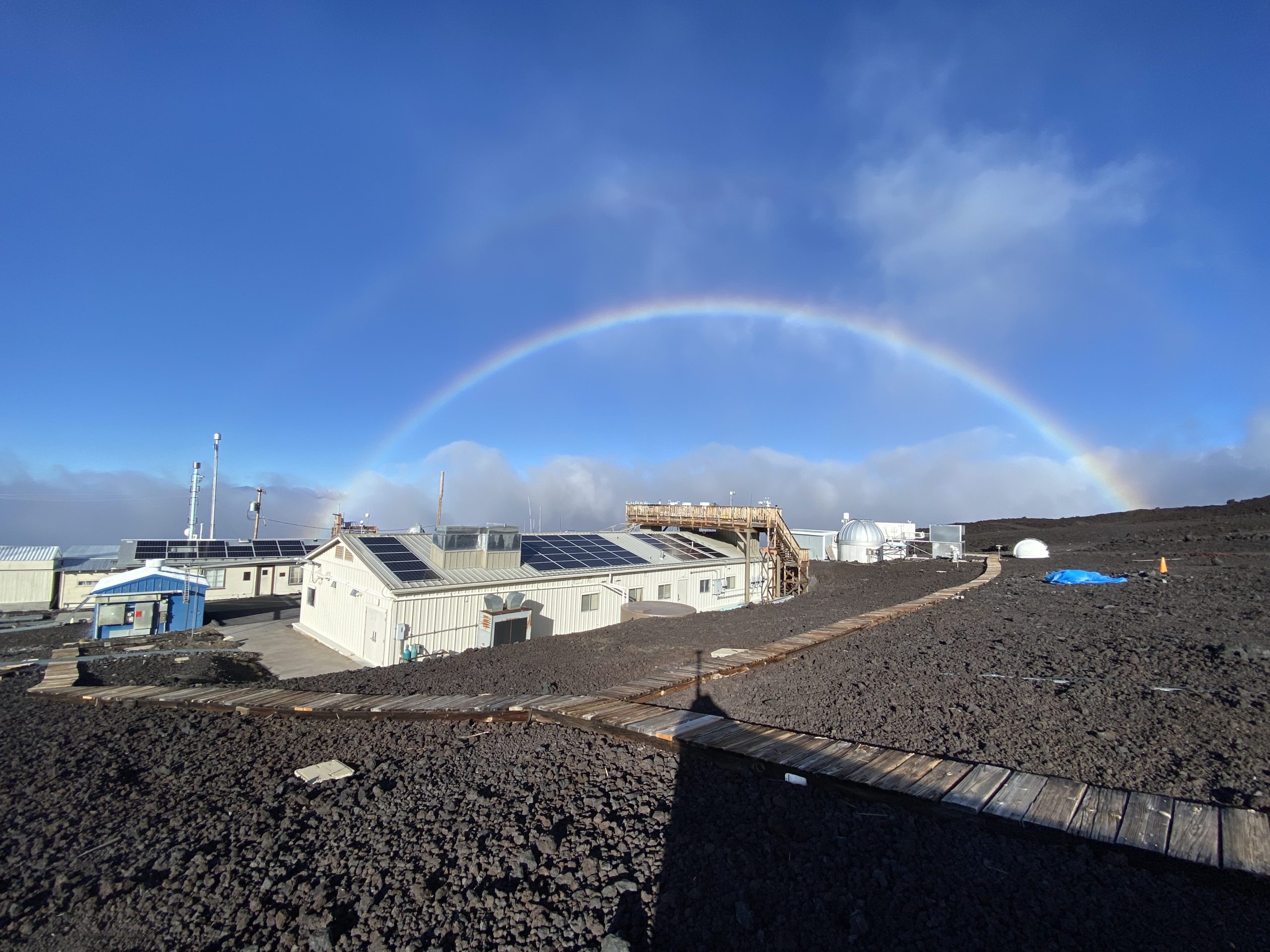
Paradoxically, volcanoes provide ideal locations for monitoring atmospheric gas concentrations due to their undisturbed air, remote location, and minimal influences of vegetation and human activity. This is why the Mauna Loa volcano is home to the NOAA Mauna Loa Atmospheric Baseline Observatory which has continuously monitored and collected data related to atmospheric change since the 1950’s. The continuous study of greenhouse gasses which warm the climate, and volcanic gasses which can temporarily cool the climate improves researchers’ understanding of how these emissions interact and impact our atmosphere and global climate. In December 2022 the lava flow of the volcano caused Mauna Loa Observatory to lose power, and NOAA researchers worked with scientists from the University of Hawaii to begin gathering measurements of CO2 at nearby Maunakea. The observatory building was not directly impacted and efforts are underway to begin measurements at Mauna Loa again.
NOAA’s research of volcanic eruptions is imperative for improving our current technologies and models used to issue warnings and advisories for tsunamis, ashfall, and air quality associated with volcanic eruptions. It also improves our understanding of how volcanic emissions and greenhouse gas emissions impact our atmosphere and global climate.
For more information, please contact Emily Ashe, NOAA Research Communications, at emily.ashe@noaa.gov.


