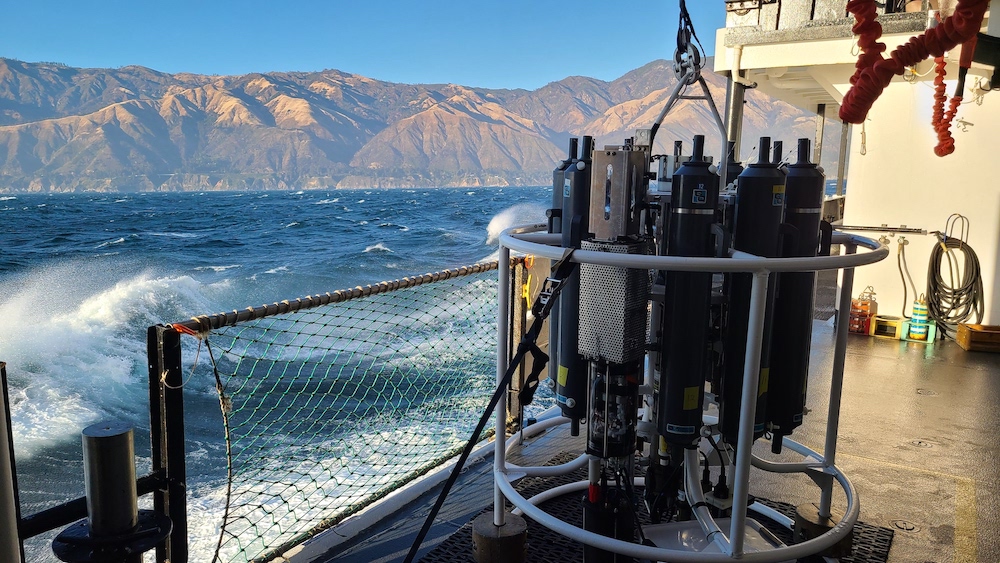
Drifters, buoys, Argo floats and more help scientists monitor the global ocean, including areas that are difficult to travel to via research ship.
200 feet…100 feet…and success! A robotic ocean glider emerges from the depths, ready to transmit the ocean data it’s collected to scientists via satellite. You might not realize it, but right now, there are thousands of instruments like this glider gathering critical data on temperature, salinity, and other factors that contribute to ocean health. Some of these ocean observing platforms stay in one place, and some drift throughout the ocean depths and over the ocean surface. Together, they help scientists monitor the global ocean, including areas that are difficult to travel to via research ship, helping researchers save money and time.
The data these platforms collect have big implications for the public. From improving forecasts to keeping tabs on important fisheries, up-to-date information on the ocean helps provide critical services. In celebration of World Ocean Month, here are four key ways NOAA collects and uses ocean data.
Tracking and predicting climate change
Ever wondered how scientists know how much the ocean has warmed over the last several decades? The answer: tools, like the Argo float, that gather ocean data.
Argo is a network of about 4,000 battery-powered, autonomous profiling floats that drift throughout the deep ocean. After floating along with the ocean currents at about 1,000 meters (about 0.6 miles) deep, about every 10 days, the floats dive down even deeper, to 2,000 meters (about 1.2 miles), and then gather data on salt content and temperature during their return to the surface. This data is transmitted via satellite and publicly available within hours of collection to researchers across the globe.
“On average, one or more scientific paper a day is published using Argo data,” said Greg Johnson, an oceanographer for NOAA’s Pacific Marine Environmental Laboratory. “So they really are a remarkable scientific resource.”
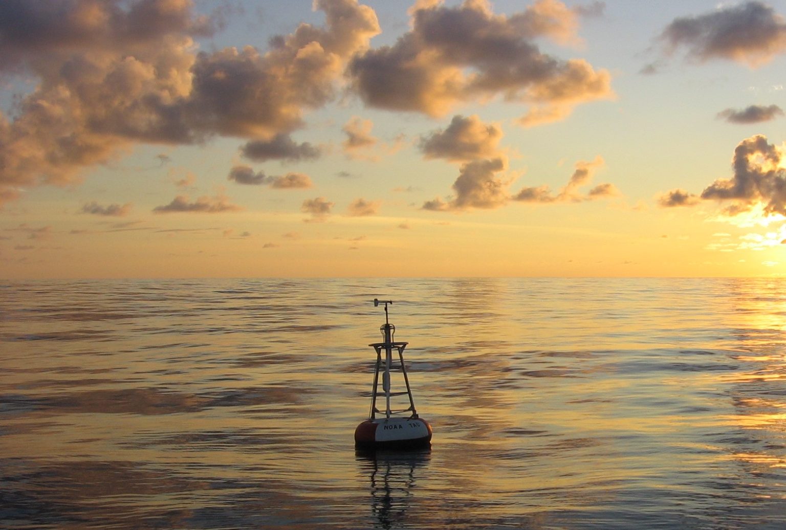
To date, the Argo Program has provided more than two million data profiles on ocean temperature and salinity, expanding our knowledge of ocean health in unprecedented ways, and helping us track heat going into the ocean. That’s important, because as the planet as a whole continues to warm, 90 percent of the extra heat produced by the burning of greenhouse gases is absorbed by the sea. The Intergovernmental Panel on Climate Change, which prepares reports on the scientific knowledge of climate change, relies on Argo data. While Argo floats drift throughout the water, NOAA’s Ocean Climate Station moored buoys are stalwarts, staying in one place for years and gathering data on ocean surface temperature, air temperature, wind, rain and much more.
With the data these moorings collect, “you can explore how and why the ocean environment has been changing, from seconds at a time to years and decades,” said Meghan Cronin, head of NOAA’s Ocean Climate Stations Group.
These data help scientists understand how the ocean is changing – knowledge that has implications for a wide range of human impacts, including tracking sea level rise and the high tides and sunny-day flooding it can bring to coastal communities; protecting ecologically and economically important coral reefs; tracking impacts on important fisheries; and predicting weather and climate variations.
Improving hurricane forecasts
When it comes to forecasting hurricane strength, knowing the temperature and salt content of the upper ocean is important. Changes in the saltiness of the ocean can affect the temperature of the ocean surface, and a warmer surface can lead to stronger hurricanes.
“If the surface of the ocean is much warmer and much less salty than the deeper layers, it will form a cap that prevents the mixing and upwelling of cool water from below,” Gustavo Goni, an oceanographer at NOAA’s Atlantic Oceanographic and Meteorological Laboratory (AOML), said last year.
To gather this information, NOAA scientists are testing out the use of gliders, robotic tools that can dive up to a half mile below the ocean surface and transmit data to satellites when they surface. NOAA and its partners will deploy up to 30 gliders this hurricane season. In May of this year, a glider in the Gulf Stream gathered ocean data ahead of early-season Tropical Storm Arthur, passing within 75 kilometers (46 miles) of the eye of the storm. The data collected by the glider – which is part of a group of gliders deployed by Woods Hole Oceanographic Institution and partially funded by NOAA’s Global Ocean Monitoring and Observing Program – were fed into forecast models in real-time as the storm evolved. Scientists plan to use the data these gliders collect to do research that will help improve the accuracy of hurricane forecast models.
Scientists at NOAA AOML also work with the Air Force to deploy drifting buoys – or drifters – ocean-monitoring devices that float with surface currents and measure just the top 10 meters of the ocean. Right now, there are more than 1,000 drifters in the ocean, measuring sea surface temperature and other data as currents carry them along.
Monitoring fish populations and ecosystem health
Making sure fish populations are healthy means keeping track of the health of their environment. NOAA’s Ecosystems & Fisheries Oceanography Coordinated Investigations (EcoFOCI) program studies the health of Alaskan and North Pacific ocean ecosystems and fisheries – a key seafood region.
“Almost half of the U.S. catch of fish and shellfish by weight comes out of the Bering Sea, so the management of that fishery is a high priority for NOAA,” said Phyllis Stabeno, co-leader of EcoFOCI.
To map fish populations, EcoFOCI scientists use unmanned saildrones. To monitor ecosystems, scientists also use pop-up buoys that hover underneath the ice, surfacing when the ice melts and gathering information about temperature, salinity, chlorophyll and more. These data help scientists and resource managers understand a fish population’s current status and predict how it might change in the future.
Scientists at NOAA and partners at the Monterey Bay Aquarium Research Institute (MBARI) are also testing the ability of long-range autonomous underwater vehicles (LRAUVs) to help conduct fisheries surveys. The LRAUVs gather samples of seawater, which are analyzed for the bits of environmental DNA – or eDNA – they contain. eDNA is present in the waste and shed skin of ocean animals, and analyzing water samples for eDNA is a new approach scientists are testing to determine what animals passed through the part of the ocean they were sampling.
Perhaps a less obvious aspect that contributes to ecosystem health? Noise. NOAA scientists are using robotic gliders and moorings to measure sound across broad areas of the ocean. Noise can threaten an ocean ecosystem’s health, so knowing how much noise different areas of the ocean are exposed to is key to getting a picture to the ocean’s overall health.
Forecasting tsunamis
Tsunamis are powerful waves that can cause devastating damage. NOAA supports two centers – the National Tsunami Warning Center in Palmer, Alaska and the Pacific Tsunami Warning Center in Honolulu, Hawaii – that provide tsunami forecasts and warnings to affected communities. In order to provide those warnings, however, the centers need data.
Enter DART buoys. These buoy systems are located in strategic spots throughout the ocean – often close to locations where earthquakes that generate tsunamis are likely to happen – and gather key data on sea surface levels as a tsunami travels past them. After a tsunami is generated by an earthquake, a sensor located at the ocean floor communicates with the DART buoy on the surface, sending info about the magnitude of the tsunami wave directly to the Tsunami Warning Centers. The centers then create an estimate of where the tsunami was generated and produce a more accurate tsunami forecast and provide communities with the appropriate alert level (Watches, Advisories and Warnings).
On average – depending on the part of the world the earthquake occurs – a tsunami can arrive at the closest coastline in about 20 minutes of the earthquake occurring, said Diego Arcas, director of NOAA’s National Center for Tsunami Research. A new generation of DART buoys, which are now in testing, may make forecasting the tsunami faster.
“The new DART buoys can be deployed much closer to where the earthquakes tend to happen, which means we can detect the tsunami wave faster than with the previous generation of buoys,” Arcas said. “When we can detect the wave faster, we can issue forecasts faster.”
These are just a few ways that NOAA monitors the ocean – research ships, satellites and other tools also help scientists collect ocean data. Want to learn more about the ways NOAA monitors the ocean? Check out NOAA’s Global Ocean Monitoring and Observing Program, the Atlantic Oceanographic and Meteorological Lab, and the Pacific Marine Environmental Laboratory to find out more. Lastly, these ocean observing efforts couldn’t be done without our academic, international and national partners, and we are thankful for these institutions!


