From its inception as an experiment to improve forecasts for aviation, to the transition of its final update to NOAA National Weather Service operations on December 2, the Global Systems Laboratory’s pioneering High-Resolution Rapid Refresh weather model established a remarkable resume of research accomplishments.
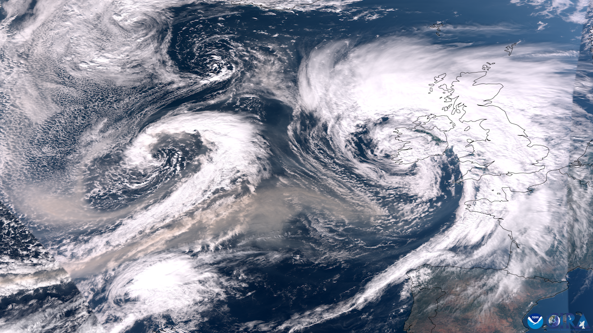
Experimental versions of the HRRR improved the accuracy of short-term hazardous weather model predictions, icing and fog guidance for aviation, as well as better predictions of precipitation from long trains of Pacific storms called atmospheric rivers, which are vital to California’s water supply. Another version improved prediction of low-level winds in complex terrain, leading to more efficient wind energy production. Transmission grid operators use HRRR forecasts to factor weather conditions into calculations of how much energy they can send down high-voltage lines.
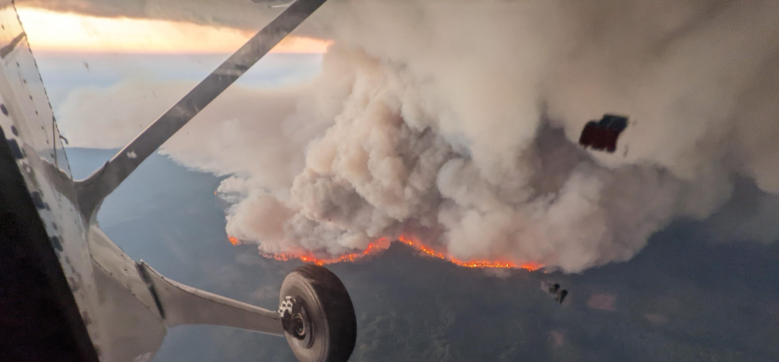
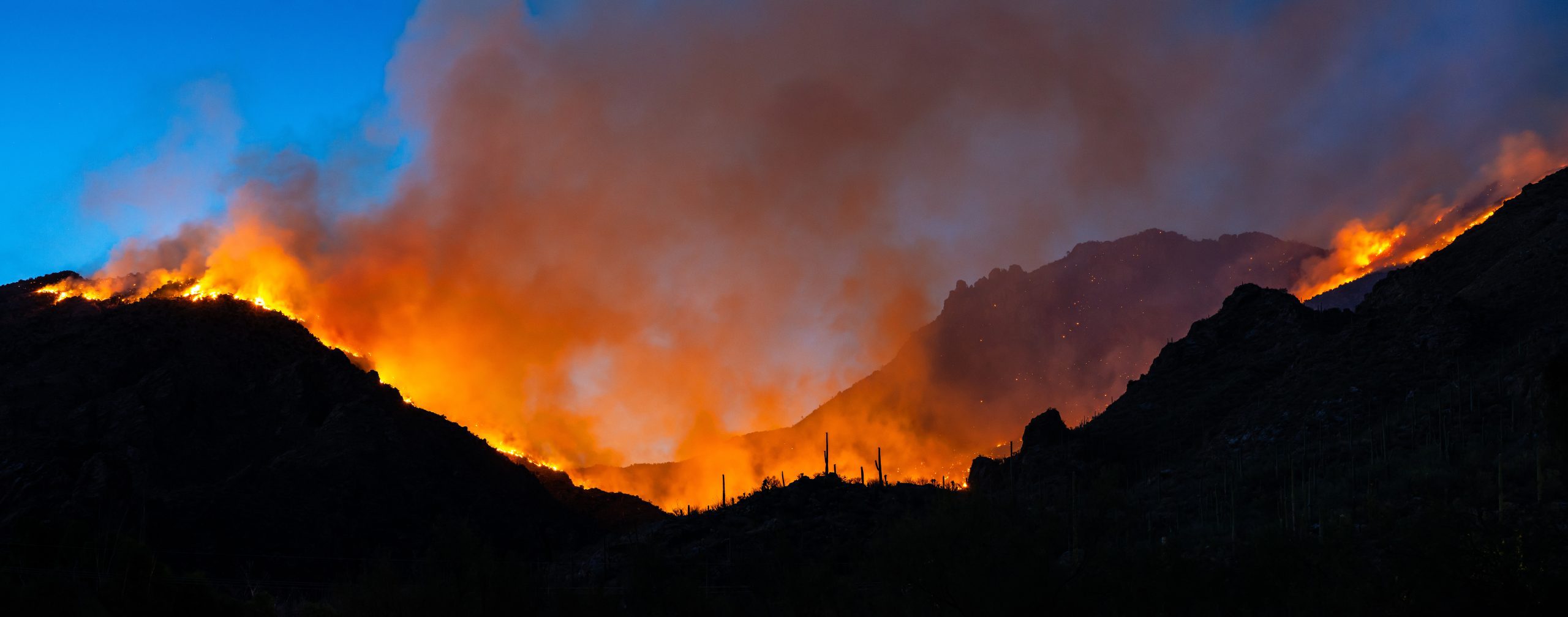
One experimental version that’s received prominent national exposure has been HRRR-smoke, which for the past three years, has become the go-to way for forecasters, public health officials, emergency operations and wildland firefighting managers to visualize the extent and spread of wildfire smoke across the country during fire season.
Over the past few years, NOAA National Weather Service meteorologists have been able to access experimental HRRR products to support the official model guidance they use to develop forecast products for the public. Now the HRRR is part of the operational model suite run by the NOAA National Centers for Environmental Prediction, the NWS environmental modeling arm.
How did one model advance so many different kinds of forecasts?
“The HRRR is so useful in a myriad of forecast applications because it does such a good job representing all aspects of the weather — wind, precipitation, clouds, thunderstorms, even smoke, and how they evolve together in the atmosphere,” said Stan Benjamin, senior scientist with NOAA’s Global Systems Laboratory and one of the principal developers of the HRRR.
First, a review: The HRRR updates forecasts hourly over the entire lower 48 United States at a resolution of three kilometers (less than two miles). That works out to nearly two million surface grid points. The HRRR also predicts the weather at 50 different elevations above each gridpoint.
It took breakthroughs in three main areas to create the world’s most accurate high-resolution continental scale model. Scientists exploited the latest supercomputing and graphical processing technologies, and developed techniques to assimilate a mountain of new weather data and observations from radar, satellites and aircraft. These advances, plus improved model physics, culminated in a model that produces a much more accurate and comprehensive representation of the atmosphere.
“Basically, when you can sweep in all of these observations of the whole Earth system, it gives you a much better estimate of what is actually happening,” Benjamin said. “When you can do that, you can run models that generate more accurate predictions of weather variables and the state of the atmosphere.”
Here are a few of notable HRRR research efforts:
HRRR-Smoke: The HRRR ingests fire radiative power data from a number of polar-orbiting NOAA and NASA satellites to calculate fire size and biomass burning emissions, and predicts the height of smoke plumes and their subsequent spread. Referred to as HRRR-smoke, this previously experimental capability is now included in the operational HRRR.
Lake-effect snow: Feeding a research version of the HRRR surface temperature and ice data from Great Lakes Operational Forecast System was shown to improve the accuracy when predicting notoriously variable – and prodigious – lake-effect snows.
AQPI: The Advanced Quantitative Precipitation Information system uses a network of advanced radars to feedi an experimental HRRR forecasting system that is coupled to runoff and coastal flooding models. AQPI will help provide better forecast guidance to California’s Bay Area decision-makers when potent atmospheric rivers come ashore. The HRRR is a foundational element of the new decision support system, which will improve precipitation forecasts and real-time estimates needed by officials responsible for responding to large rain events. It’s expected to become operational in 2021.
Wind forecast improvement: Researchers collected 18 months of data to better understand how terrain and weather interactions affect wind speed and turbulence at the height of wind turbines. Researchers used their results to improve the representation of low-level winds in the HRRR. The upgrades to the low-level wind model forecasts improved wind energy forecasts by 15-25 percent (as reported by wind energy firms), as well as daily wind forecasts for the entire country.
What’s next?
This final delivery of these HRRR model systems will serve as the foundation for NOAA’s advanced regional, convection-allowing model in the Unified Forecast System, known as the Rapid Refresh Forecast System.
For more information, contact Theo Stein, NOAA Communications: theo.stein@noaa.gov